Know Your Place
Cottesloe
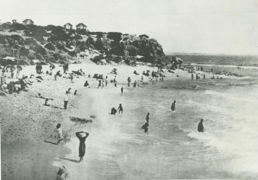
Photo: Muderup Rock as it was in 1900.
Nyoongar people believe that their ancestors have lived in the Southwest of Western Australia since time began, with evidence confirming their occupation for at least 45,000 years. Within the Town of Cottesloe, two places of significance for First Nations’ peoples have been registered on the Department of Indigenous Affairs Aboriginal Sites database, being Mudurup and Rocky Bay.
‘Mudurup’ or Moonderup (pronounced ‘Moordoorup’ or ‘Murdarup’) is a ceremonial site located at Mudurup Rocks, south of the Cottesloe Surf Life Saving Club. Mudurup Rocks is considered one of the most important spiritual coastal sites on the Swan Coastal Plain. ‘Mudurup’ means ‘place of the whiting’.
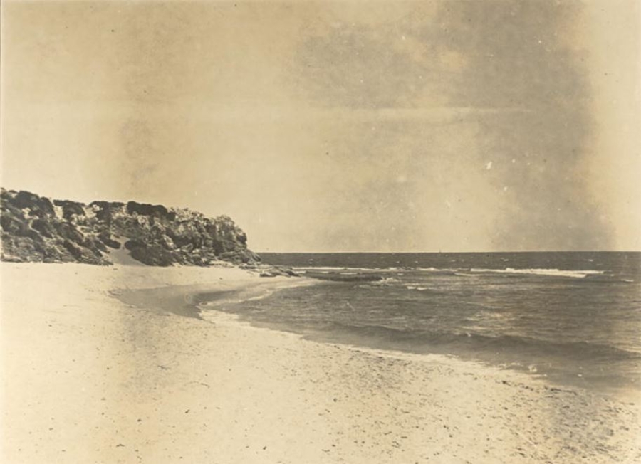
Photo: Muderup Rock in the 1920's
Before European settlement in Cottesloe, Nyoongar peoples fished at Mudurup during mid to late summer, the seasons of Birak (December to January) and Bunuru (February to March).
‘Rocky Bay’ is the second registered significant site and identifies the narrow crossing point between Rocky Bay on the Swan River in Mosman Park and the Indian Ocean at the south end of Cottesloe. A further two unregistered sites where artefacts have been recorded are at Victoria Street Station and Macarthur Street. These sites reflect camps along the route taken by Aboriginal peoples as they moved between the ‘Derbarl Yerrigan’ (Swan River) and the coast, according to the seasons and food sources. (Source: Town of Cottesloe – ‘History of the Town of Cottesloe).
The Tamala Limestone along the coastline of Cottesloe provides evidence of the sea level changes that have occurred between 750,000 to 10,000 years ago. The cliffs at Mudurup Rocks contain rhizoliths which are calcified fossil roots structures and large broken shells of gastropods.
The Cottesloe that we all know and enjoy today has evolved over many years. There are so many elements of Cottesloe that we experience without the knowledge of the significance behind them. The purpose of this sharing of information is to promote an appreciation of what has come before us in the hope that this will inspire new things going forward that reinforce the essence of the place.
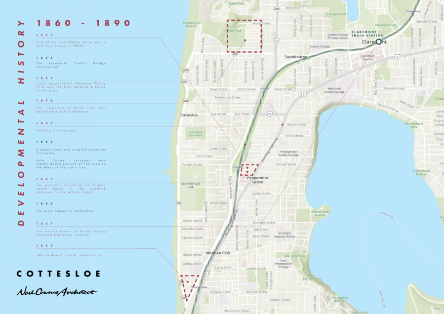
The first recorded visit by Europeans to the Cottesloe district occurred much earlier with the arrival in January 1697 of three Dutch ships under the command of Captain Willem de Vlamingh Alternative research suggests that it was more likely that the party form the Dutch ships landed at Swanbourne Beach. (Source: ‘Cottesloe a Town of Distinction’ by Ruth Marchant James).
It was a further 132 years before any settlement was made. The first of a group of British settlers (under the command of Captain James Stirling) to settle in Cottesloe was John Butler on 250 acres with river frontage (now Peppermint Grove). Butler built a house for his family beside the rough track between Perth and Fremantle. The house soon gained a reputation for the excellent hospitality provided to travellers of the track and became known as the 'Bush Inn' or 'Halfway House'.
Convicts, transported from the United Kingdom, were put to work on the Perth to Fremantle track and in 1858 the road was completed. In 1872 the road was declared a public highway. The Perth to Fremantle railway line was completed in 1881 and a siding was constructed, which became known as 'Bullen's Siding'.
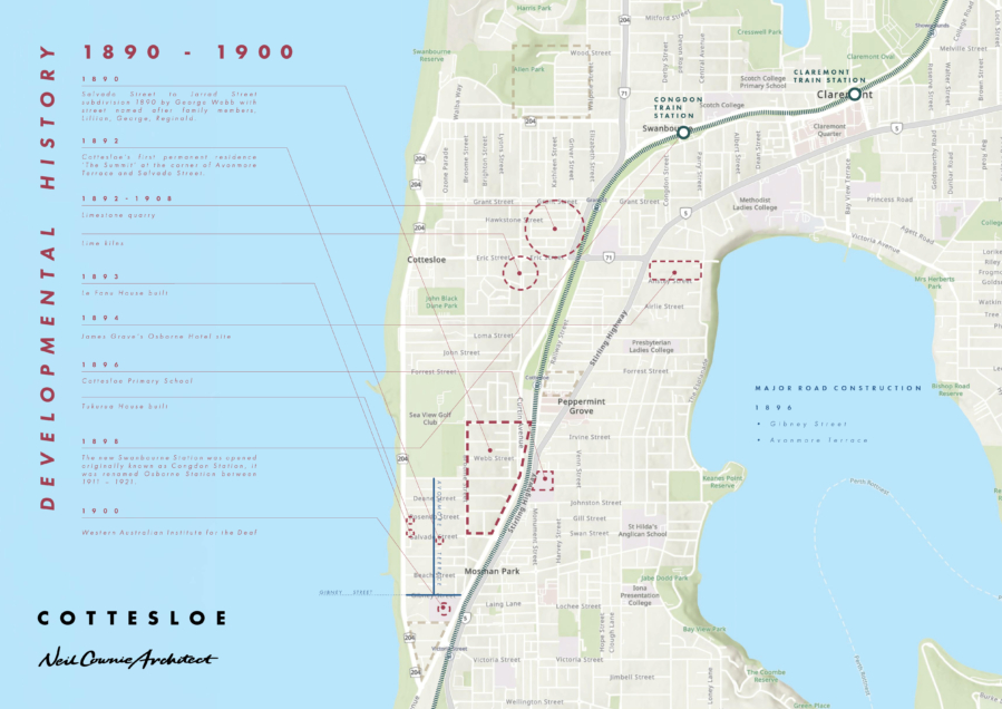
Cottesloe was declared a suburban area at the time it was officially named, but it was nearly two years later before the first 4-acre lots were sold. In the mid-1890s there was a rush to take up land and a number of houses were erected. The first permanent residence to be built near Cottesloe Beach was 'The Summit' in Avonmore Terrace for Mr and Mrs J.C.G. Foulkes. By 1898 the population of Cottesloe was 1,000.
The first decade of the 1900s saw a change in the status and further development of Cottesloe. With the intention of attracting new residents, the Roads Board developed and promoted the beach front. However, issues soon arose over beach attire and behaviour including the contentious issue of mixed bathing. Safety then became the dominant concern, leading to the formation of volunteer life-saving patrols in 1908, which in turn led to the formation of the Cottesloe Life Saving and Athletic Club and the erection of a clubhouse.
After a referendum of residents, government approval was sought for the conversion of the Cottesloe Roads Board to a municipality. The Cottesloe Municipality was approved and gazetted on 20 September 1907. John Stuart was elected as the first mayor and the first Council was formed. In 1908 Lord Cottesloe gave permission for the municipality to use his coat of arms.
As the community grew, churches and places of work ship were constructed, several new charitable institutions opened, and another primary school opened. The Ocean Beach Hotel opened in January 1908 and the Hotel Cottesloe was built in 1905. Both establishments have maintained their positions and popularity to the present day.
Sport and leisure activities became popular in the area, and the Cottesloe Golf Club was formed in 1908.
The newer northern area of Cottesloe was sub-divided while the existing sparsely populated areas of Cottesloe were infilled with new buildings throughout this period.
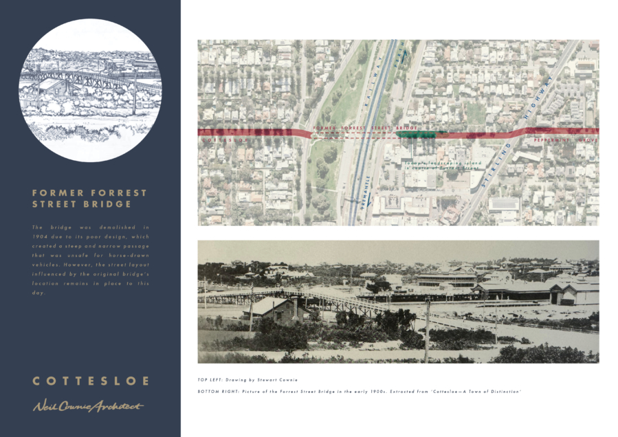
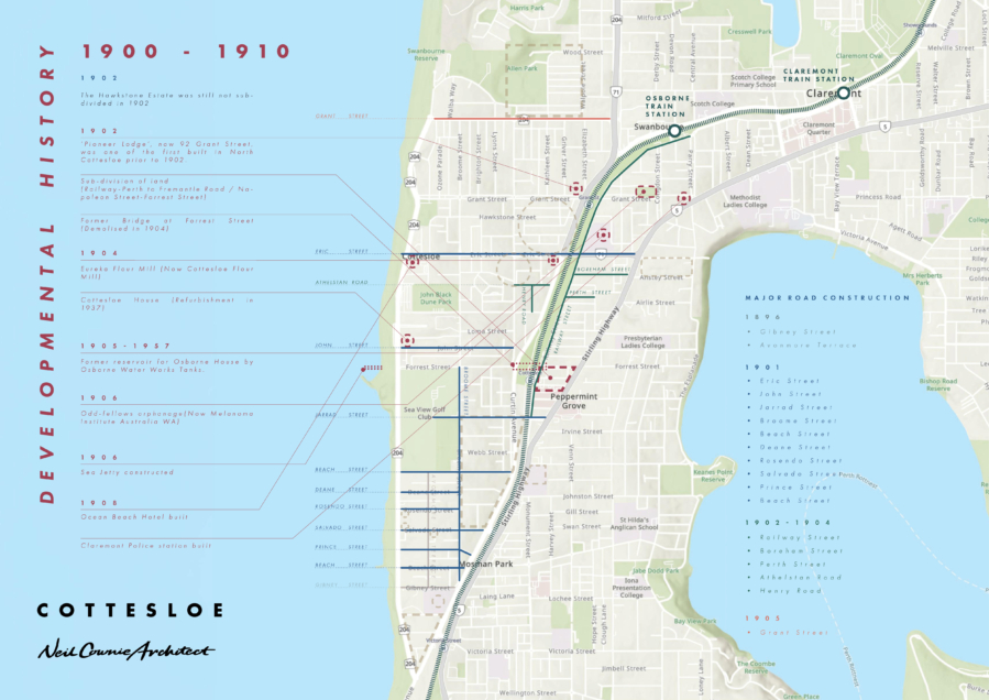
Interestingly the park median strip central to Forrest Street just east of the train line once served as the landing place of a bridge over the train line in 1902. The bridge was shot lived due to the inadequate design which made use of the bridge very difficult. The bridge was demolished in 1904. Despite the short life of the bridge, the street planning layout resulting from the location of the bridge remains in place to today.
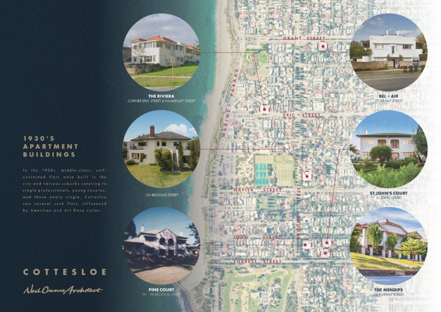
With new apartment buildings seemingly the scourge of established neighbourhoods, we have excellent examples of how to increase density right under our noses. These 1930's low rise apartment buildings, or 'flats' as they were known were built for young couples, professionals and those newly single. Such buildings were often in an Art Deco style.
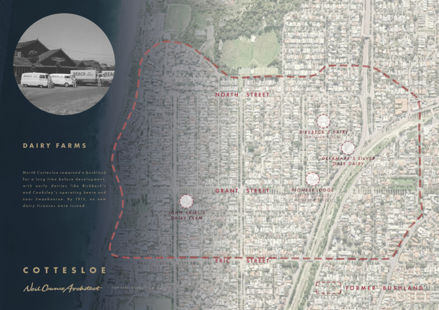
Ruth Marchant-James writes: 'Sections of land in the northern portion of the district proved to be suitable areas in which to establish dairies. Early North Cottesloe dairies operating near the border of Swanbourne included Birkbeck’s, Cooksley’s, Newman’s Leinster’s and Delamare’s. Grazing lands ran down almost to the railway line and as far north as the land on the current rifle range in Swanbourne. By 1915 the Cottesloe Council decided that after that calendar year, no future licences would be issued for local dairies.’ This Kathleen Street house, constructed in 1908 was originally completely surrounded with local dairies and must have accommodated people associated with the dairy industry.
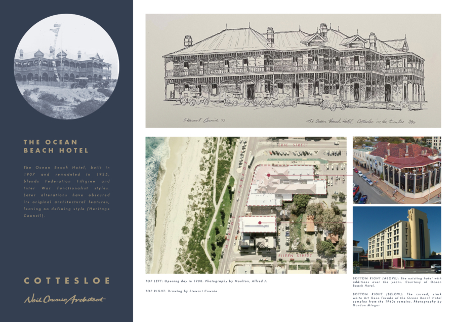
The Ocean Beach Hotel was designed by Louis Bowser Cumpston for the Swanbourne Syndicate and was completed in 1907. The hotel officially opened on the 3rd January 1908. The hotel became a favourite place for newlyweds to honeymoon and is said to have been the place for many a war time romance.
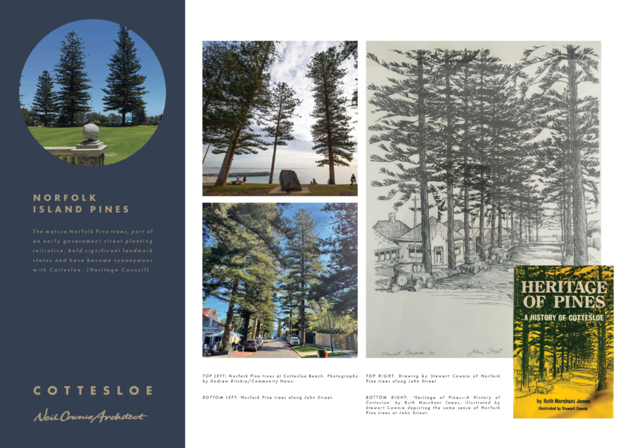
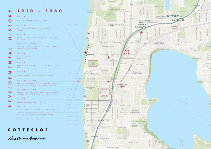
One of the most significant historical influences on the current day character of Cottesloe was the planting of Norfolk Island Pine trees. Their origin dates back to 1915 when the then Roads Board purchased 168 small Norfolk Island Pines in an effort to beautify the suburb. The small saplings were planted along John Street and watered by the Roads Board. Other accounts credit the Zimpel or Doscas families with the planting of the pines in John Street dated 1917 and then caring with them with water collected from their own wells.
Neil's father, Stewart Cownie collaborated with author Ruth Marchant-James in the much heralded 1977 book on the history of Cottesloe titled 'Heritage of Pines'. Stewart Cownie illustrated the book with hand drawings of the built features within the suburb. The new updated version of the history of Cottesloe by Ruth Marchant-James titled 'Cottesloe a Town of Distinction' replaces Stewart Cownie's illustrations with photos. The book does contain a map of landmarks within the suburb that acknowledges the original map created by Stewart Cownie within 'Heritage of Pines'.
The suburb of Cottesloe provides a tapestry of architectural styles from the early years of Federation houses, English Edwardian, Queen Anne, Georgian, Italianate, Arts & Crafts to the inter-war period of Modernist, Spanish Mission and Californian Bungalow styles. More recently contemporary architecture is often replacing many of these older buildings.
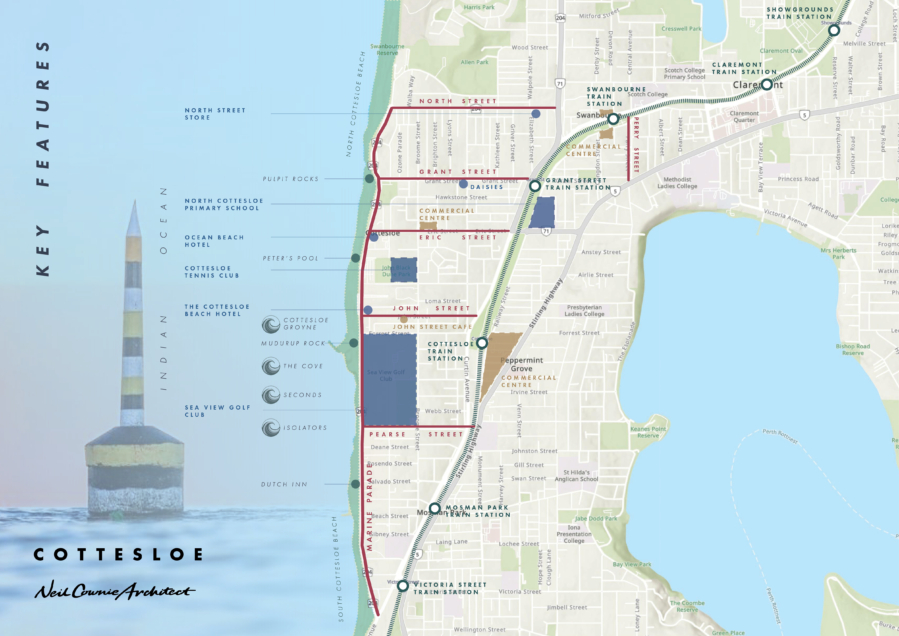
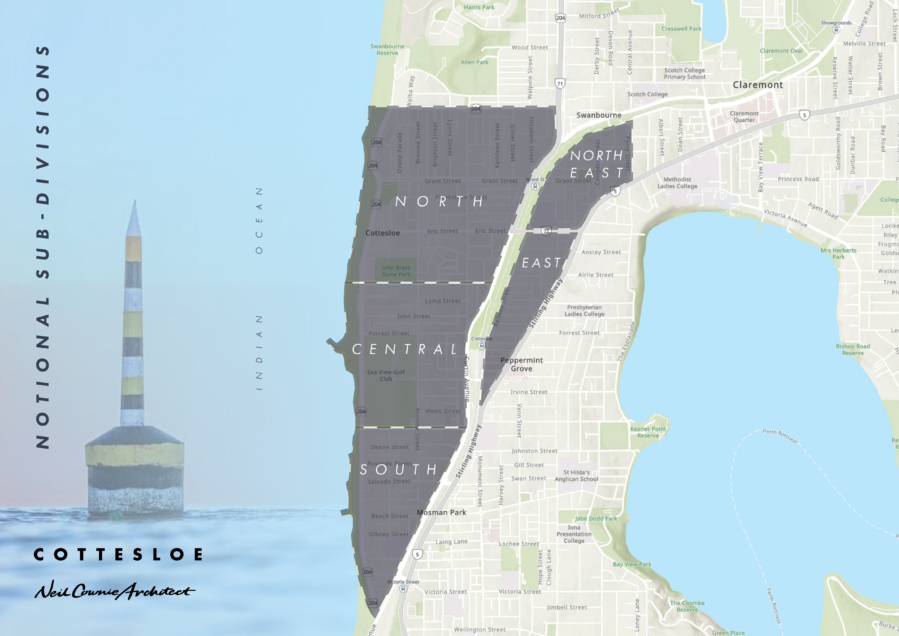
Cottesloe is not one homogeneous place, but rather the name Cottesloe covers at least five urban areas that portray specific character. Cottesloe is divided by the train line, Stirling Highway, Curtin Avenue, Eric Street and the Sea View Golf Course into distinctive zones.
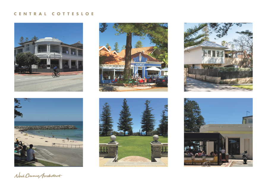
I am referring to ‘Central Cottesloe’ as the area bounded to the north by Eric Street and to the south by Pearce Street and to the east by the train line. This zone alone could very easily be divided into more sub-categories thanks to the varying terrain and proximity to the more public areas of commercial activity.
Central Cottesloe was developed some ten years after the most southern portion of Cottesloe with streets such as John Street created in 1901. The original Cottesloe hotel, a two-story timber building was constructed in 1904 and constructed as we experience now in 1934.
The area between Jarrard Street and Webb Street was sold as part of a larger land subdivision in 1890 to George Webb who named the streets in the subdivision after family members. The Jarrard to Webb Street portion of the subdivision was used as a limestone quarry until 1934 when the quarry was infilled to create the streets and residential lots. Similarly, the area around Marmion Street and Clarendon Street was the location of lime kilns, conveniently located near an adjacent limestone quarry. In 1915 Norfolk Island pine trees were first planted along John Street and what is now known as marine Parade.
In 1906 a timber sea jetty was constructed on Cottesloe beach and a shark net was constructed between the timber jetty and two pylons. In a storm one of the plylons was washed away leaving the one pylon that is still enjoyed to this day by swimmers. In an attempt to reduce the annual erosion of beach sand a groyne was constructed in 1960 which is located in front of Muderup Rocks.
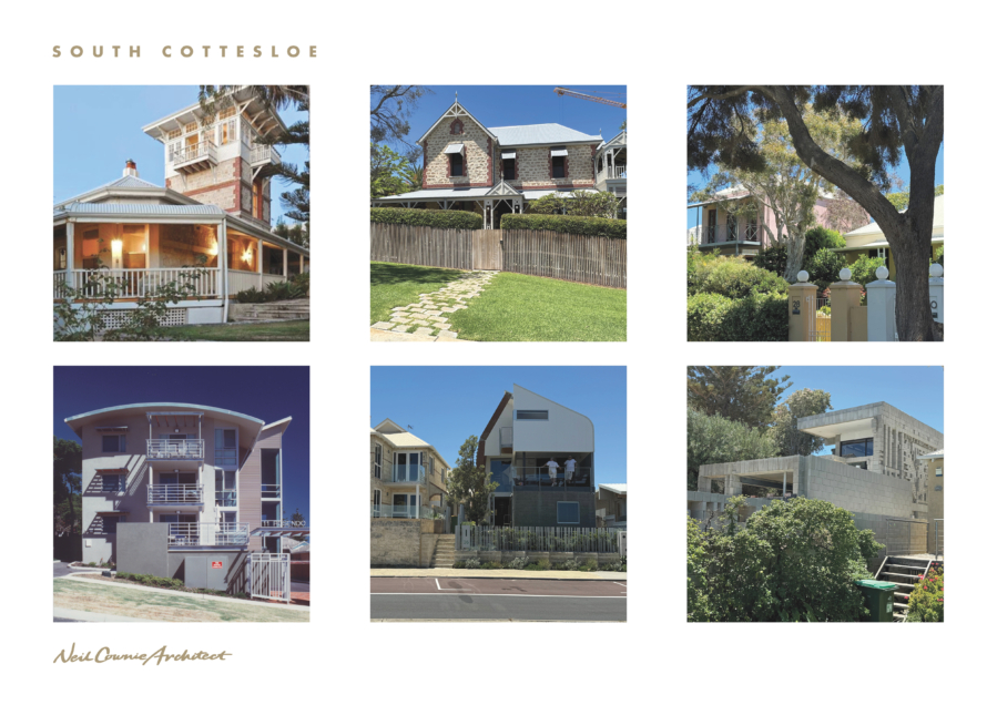
I am referring to ‘South Cottesloe’ as the area bounded by Pearse Street to the north, the railway to the east as it converges with the coastline.
The most southern portion of Cottesloe was the first area developed and was originally released with lots for sale in 1889 when the subdivision was known as ‘Manly Estate’.
South Cottesloe has a relaxed mood and is strongly connected to the ocean. There are many historic houses in this precinct that include Tukurua (originally designed by R.T. McMasters and later altered with a first floor by architect J. Talbot Hobbs), Le Fanu House (Constructed in 1893 was originally known as ‘Banksia’, with substantial alterations in 1900 by architect Percy Williams), Belvedere (a limestone house built in 1896 is complete with tower to enable the original owner, a retired sea captain to observe the ships on the ocean), and the most southern house being the timber cottage known as Bonavista built in 1907.
This precinct also contains apartment buildings from the 1960’s and an ‘urban intervention’ by Phillip Cox Etherington Coulter Jones Architects along the eastern ends of Princess Street and Beach Street.
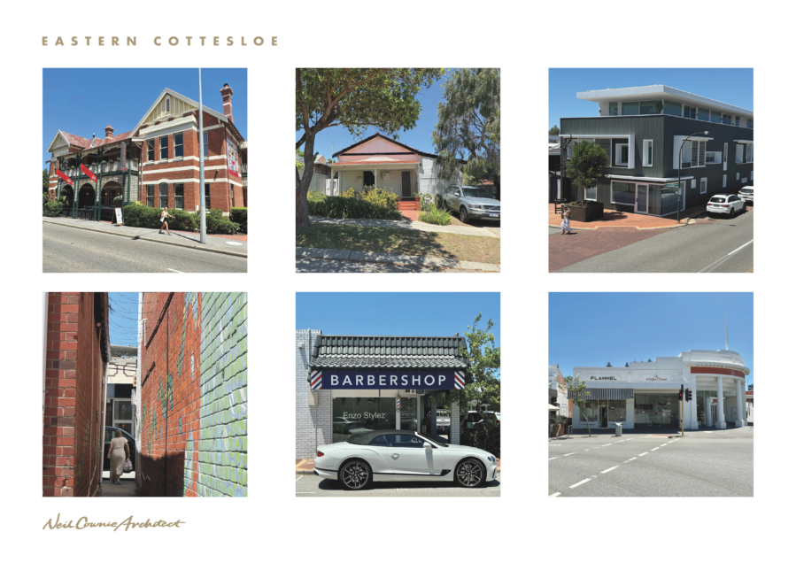
I am referring to ‘Eastern Cottesloe’ as the area bounded to the north by Eric Street in the wedge between the train line and the convergence of Stirling Highway to the south.
This portion of Cottesloe is in two parts with small lots in a north / south orientation to most of the precinct and with the commercial areas of Napolean Street, Station Street, Forrest Street at the southern end. Like the disconnected streets of north-eastern Cottesloe due to the construction of the train line (1881), another example of this is Forrest Street which bares the same name on both sides of the train tracks such as with Napier and Forrest Streets.
On the site of the Albion Hotel was the former ‘halfway house’, constructed in the 1860’s. The area around the Albion Hotel in the period around 1885 served as an Afghan camel depot in the paddock next to the hotel. In 1902 a land subdivision was created between Forrest Street and Napolean Street between the train line and what is now Stirling Highway.
Another land subdivision occurred in 1902-1904 when Perth Street, Boreham Street & Dalgety Street was created.
Interestingly the park median strip central to Forrest Street just east of the train line once served as the landing place of a bridge over the train line in 1902. The bridge was shot lived due to the inadequate design which made use of the bridge very difficult. The bridge was demolished in 1904. Despite the short life of the bridge, the street planning layout resulting from the location of the bridge remains in place to today.
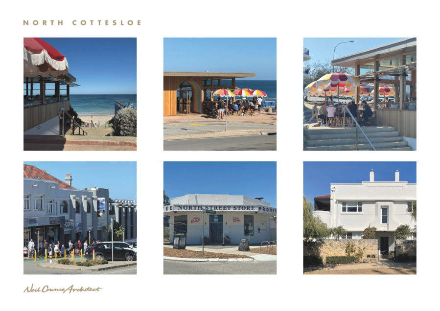
I am referring to ‘North Cottesloe’ as the area bounded to the north by North Street and to the south by Eric Street, the train line to the east and the ocean to the west. The northern portion of this precinct ‘bleed’ into the suburb of Swanbourne to the north side of North Street. North of Grant Street this precinct has relatively narrow east / west orientated lots, while south of Grant Street the relatively narrow lots are orientated north / south.
This area features the Ocean Beach Hotel, North Cotttesloe Surf Club, a commercial centre on Eric Street, the popular Dasies and North Street Store.
Ruth Marchant James in her book ‘Cottesloe a Town of Distinction’ provides an outline of what this part of North Cottesloe was like in the early 1900’s: ‘Unlike South and Central Cottesloe, North Cottesloe remained unoccupied bushland for a long period. From the top end of what is now Eric Street, to the east of Congdon Street and the present North Street, the area was thick with gum, banksia, wattle, she-oak and Christmas trees and in the springtime the ground was a Mass of colourful wildflowers. For a long time only, a few scattered dwellings could be seen with the isolated ‘Pioneer Lodge’ at what is now Grant Street being one of the first buildings erected’. Ruth Marchant James goes on to write: ‘Sections of land in the northern portion of the district proved to be suitable areas in which to establish dairies. Early North Cottesloe dairies operating near the border of Swanbourne included Birkbeck’s, Cooksley’s, Newman’s Leinster’s and Delamare’s. Grazing lands ran down almost to the railway line and as far north as the land on the current rifle range in Swanbourne. By 1915 the Cottesloe Council decided that after that calendar year, no future licences would be issued for local dairies.’ This Kathleen Street house, constructed in 1908 was originally completely surrounded with local dairies and must have accommodated people associated with the dairy industry.
Unlike South Cottesloe, North Cottesloe, remained unoccupied bushland for a long period. From the top end of what is now Eric Street, to the east of Congdon Street and the present North Street, the area was thick with gum, banksia, wattle, she-oak and Christmas trees and in springtime the ground was a mass of colourful wildflowers. In season, there was always a riot of purple native wisteria and white clematis and motley profusion of yellow, white and pink donkey, spider, and slipper orchids. In certain areas countless red and green kangaroo paws, cats-paws, pink myrtle and prickly yellow wattle carpeted the ground.
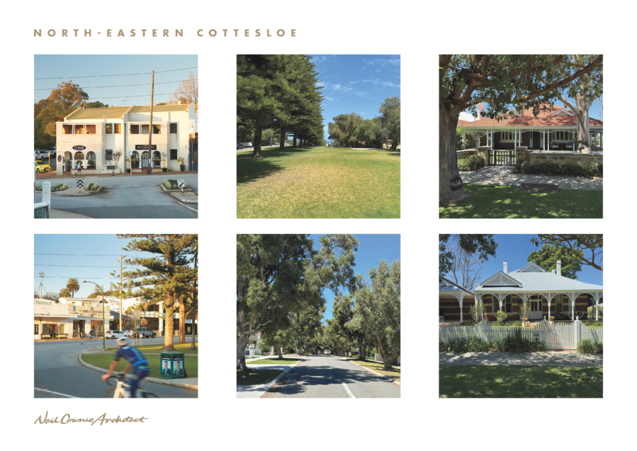
I am referring to ‘North-Eastern Cottesloe’ as the area bounded to the east by Parry Street, to the north and west by the train line, Stirling Highway to the south east and Eric Street to the south. Much of this area feels more connected to the Swanbourtne community than it does to the southern portion of Cottesloe. Large historic houses on larger lots front Grant Street, Parry Street & a portion of Mann Street, with generally smaller lots and historic houses to the remainder of the precinct. The strip parks central to Grant Street and Congdon Street are features of the area. This precinct also includes the historic Osborne Fire Station and Claremont Police Station.
This portion of Cottesloe was disconnected at the time the train line was constructed in 1881. It is interesting to note that the original street names continued across the train track in Grant Street and Servetus Street with the southern portion of Servetus Street ultimately being renamed Mann Street.
This portion of the suburb once served the Osborne Hotel with Jasper Green Reserve being the former location of the reservoir for the hotel and the fire station taking the name of the hotel. Swanbourne Station was originally known as Congdon Station (after the adjacent street name) was renamed Osborne Station (1911 – 1921) to commemorate the nearby Osborne Hotel and Loreto Osborne College.
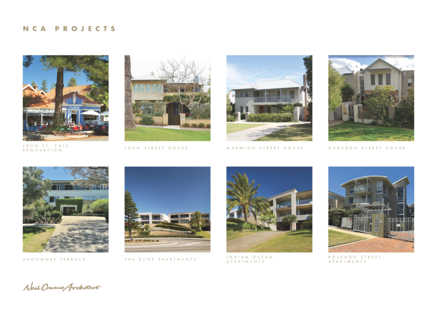
Neil's design work can be found throughout Cottesloe which includes new single houses, apartment buildings, residential additions, a sympathetic covered outdoor area to the John Street Cafe and the refurbishment of a 1960's apartment building.
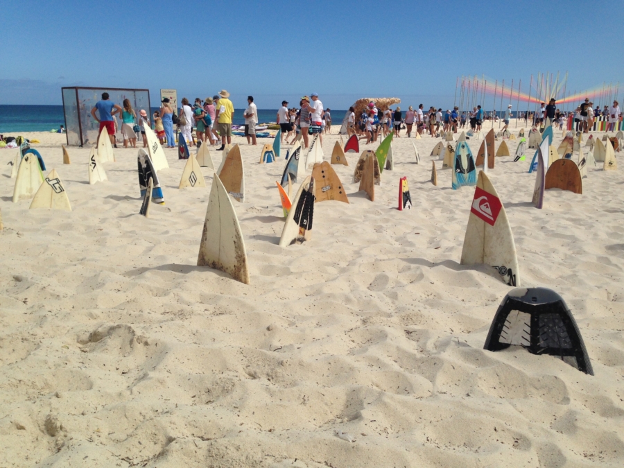
Following the popularity of the annual sculpture exhibition in Bondi, Sydney, in 20025 saw the beginning of its very own Sculpture by the Sea.
Taking the children each year to visit the Cottesloe Sculptures by the Sea became a much loved experience.
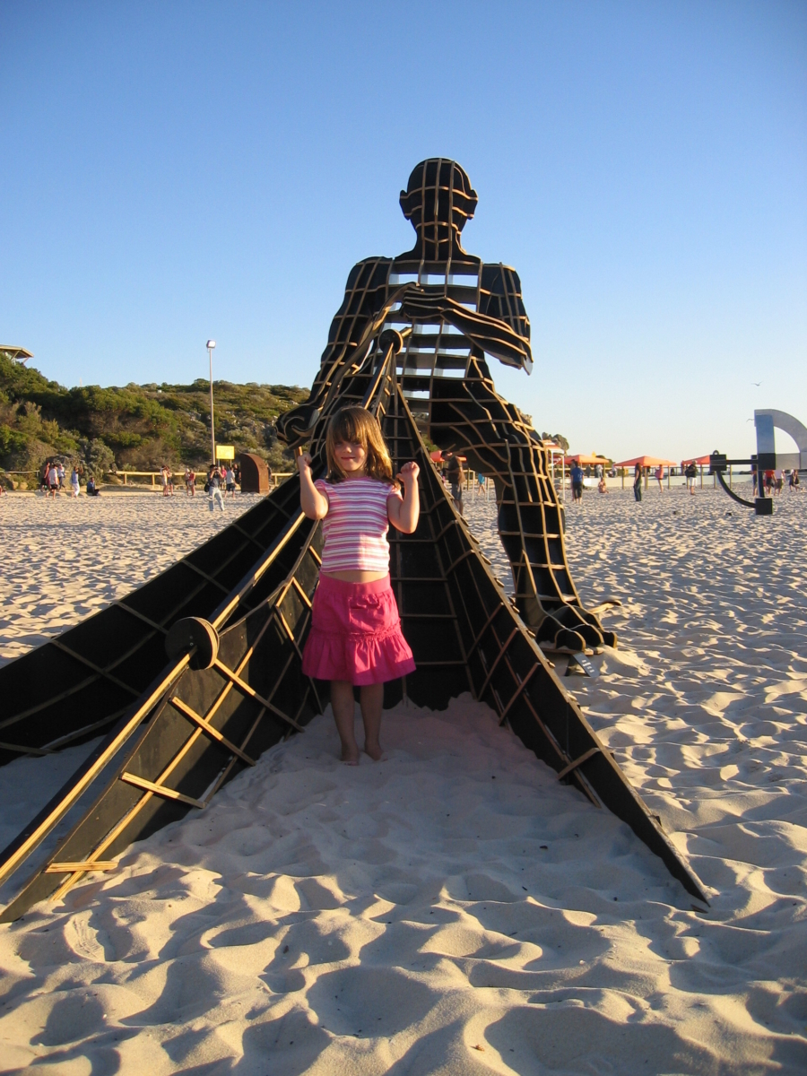
Life imitating art as a much younger Ruby Cownie imitates the sculpture in 2006.
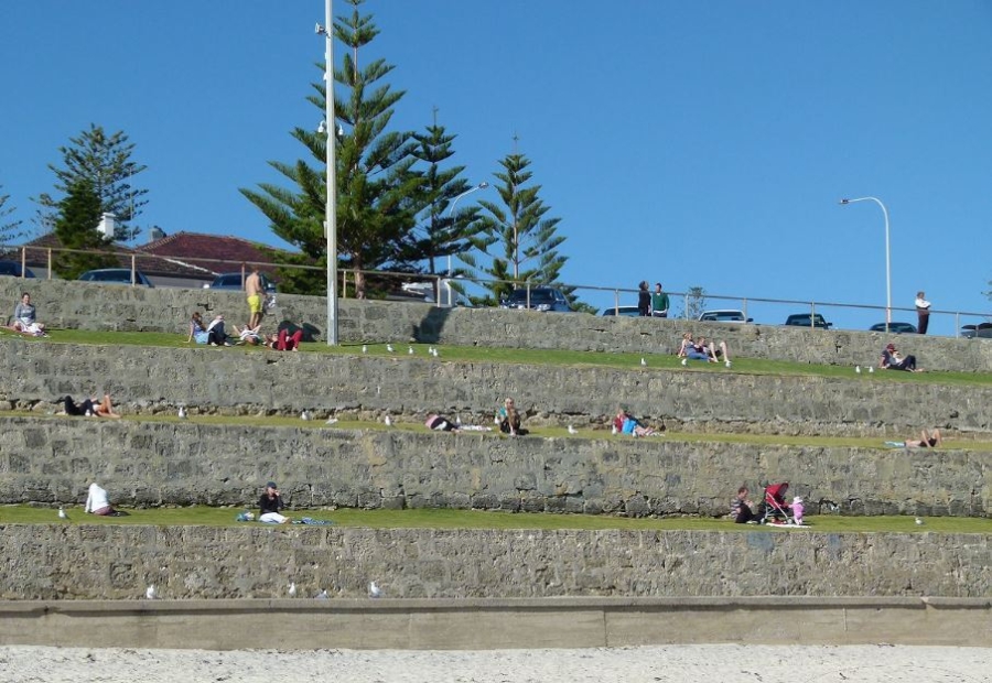
A dominant feature of the Cottesloe beachfront are the limestone and lawned terraces. The limestone retaining walls to the terraces were constructed in the early 1930's.
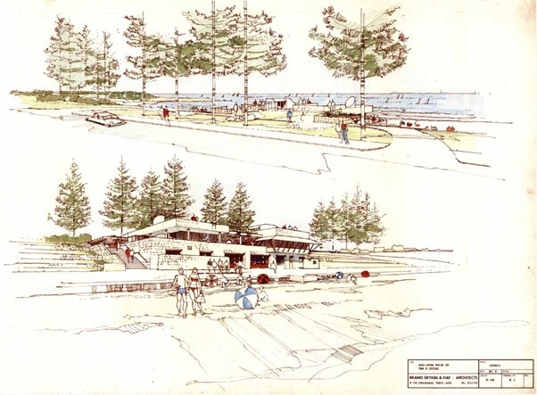
These drawings show the 1981 proposal commissioned by the Town of Cottesloe for a new boatshed, changerooms and cafe by architects Brand Deykin & Hay. This proposal was to replace the damaged Centenary Bathing Pavilion.
This scheme would have sat very comfortably in the location that we now see the Cottesloe Pavilion building. In this scheme with its robust forms and the materiality in the use of limestone would have been an excellent addition to the Cottesloe beachfront. The material selection of limestone alone made a strong reference to the importance of the limestone Muderup Rocks ands their significance to Noongar people and also to the lime kilns and quarries which were found throughout the Cottesloe area.
Unfortunately this scheme did not proceed and it was replaced with the 1983 vaulted roof pavilion, still evident to this day under the Cottesloe Pavilion building.
The surf break known as Isolator on a small yet crowded summer day.