Part of a series of posts by Neil Cownie on The Future of Swanbourne Village
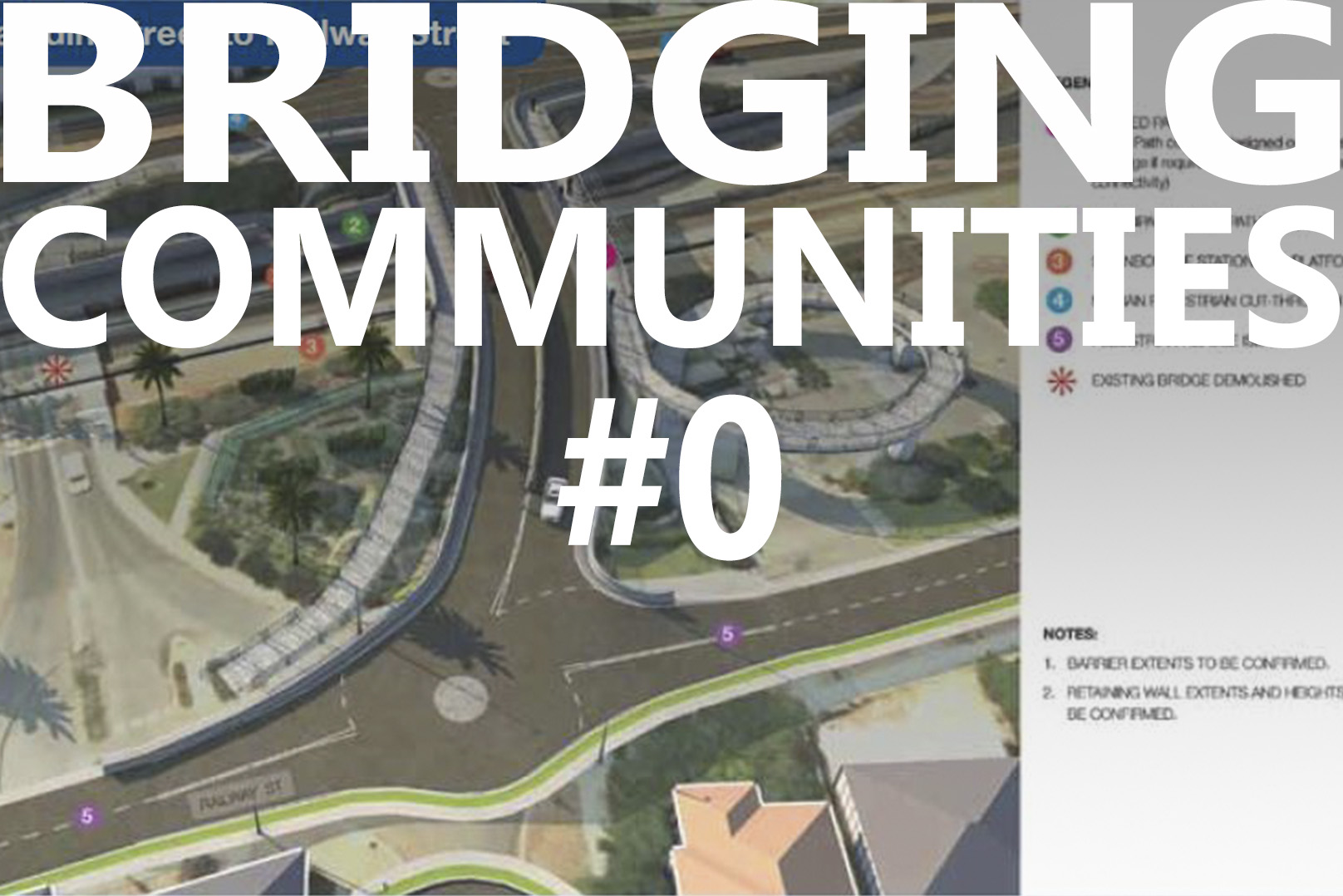
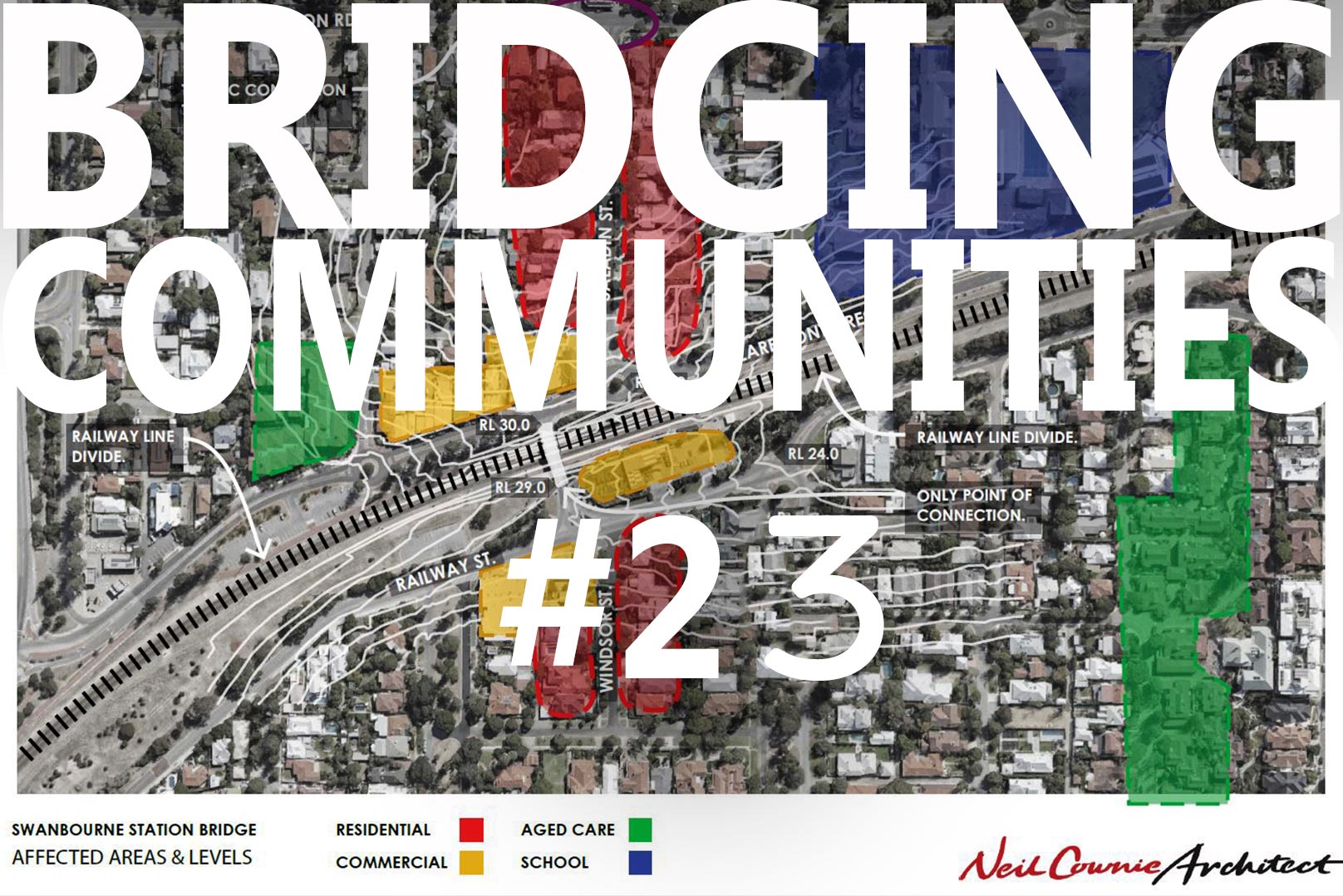
From this diagram, central to the ‘Swanbourne Village’ is the existing bridge and the railway station. Businesses exist to both sides of the railway line central to the bridge.
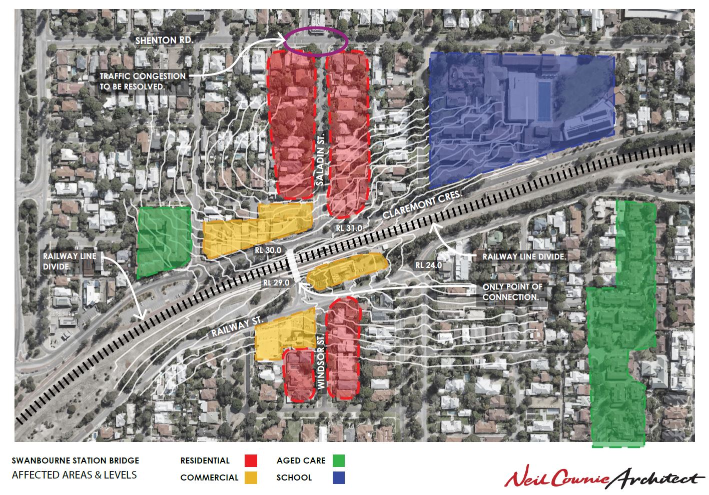
The location of the existing bridge is at the natural high point that is very similar on both sides of the railway line: thereby being the perfect location for a bridge as this means that the bridge is a simple extension of the road levels which avoids the need for long ramps (unlike the proposed new bridge). Levels can be seen in the white lines of the natural contours. Spot levels indicate a one-meter difference in level to both road surfaces at either end of the existing bridge. Note that at the existing round-about at Saladin Street the ground level is one meter higher than the existing bridge. This then requires the proposed new bridge to transfer the level difference in excess of 2 meters which results in ramping being required. This leads to the appearance of a ‘freeway off ramp’, rather than a ‘bridge’ on the south side of the new bridge.
Also note the local community functions of aged care and schools that result in pedestrian access across the railway line at the point of the existing bridge.
Drawing by Neil Cownie Architect.
Go back to the The Future of Swanbourne Village
The Bridging Communities Series
- #0 The Precinct - Swanbourne Bridge
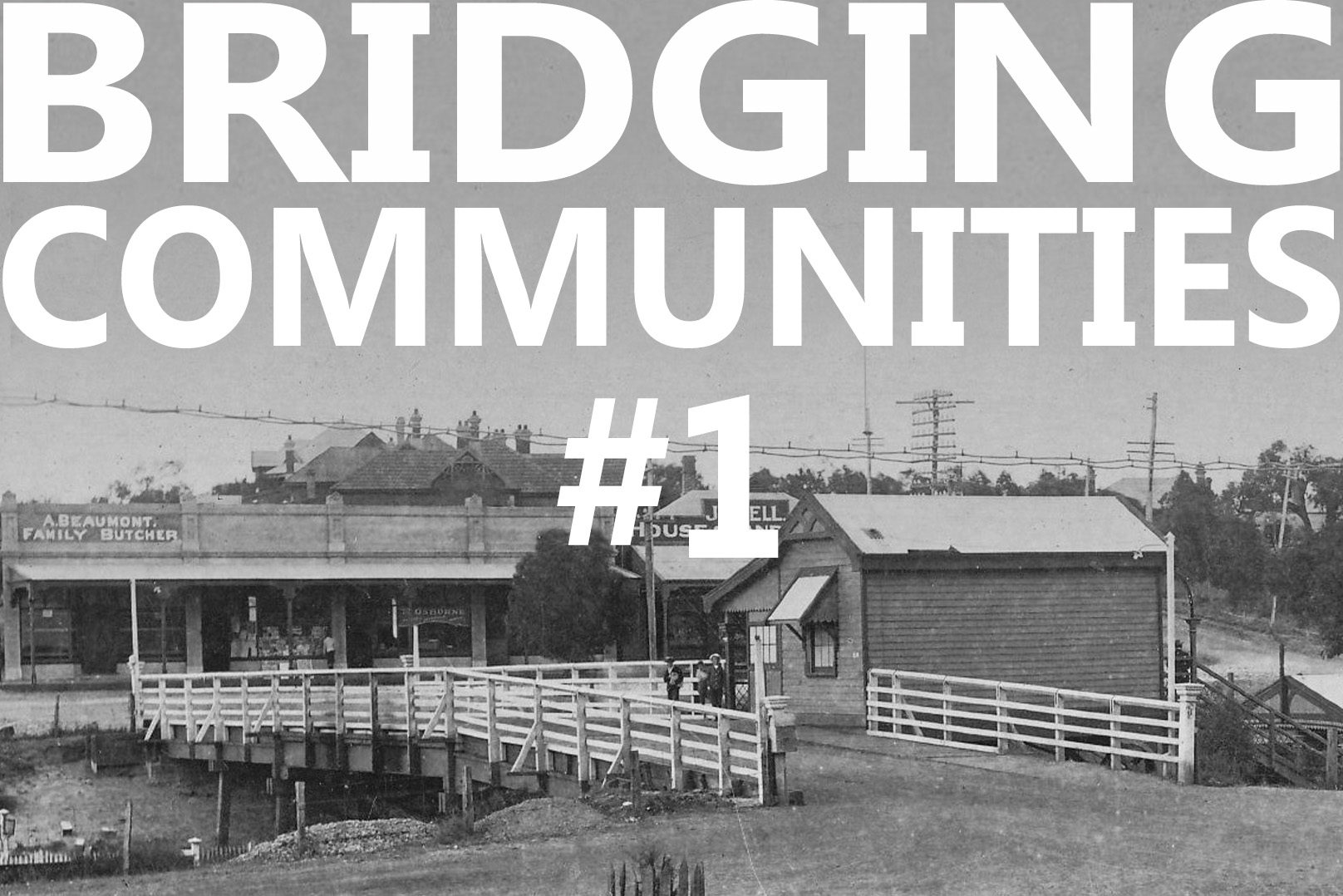
- #1 Old Swanbourne Bridge
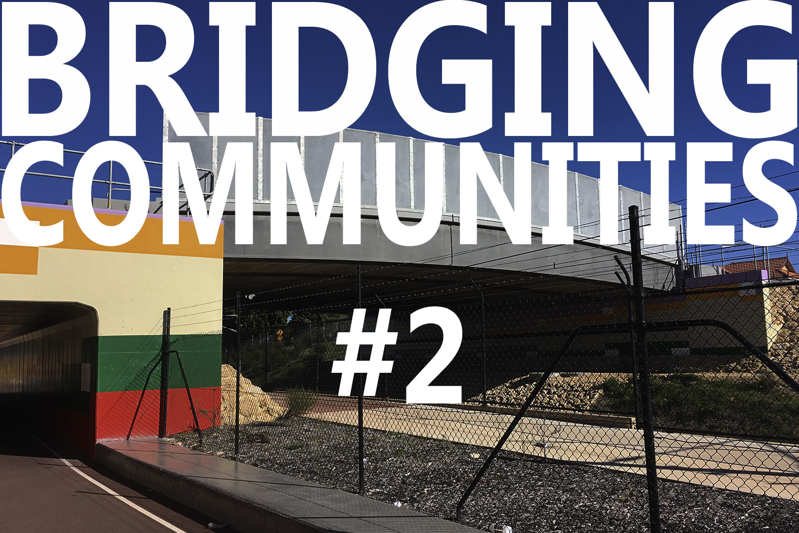
- #2 Third Avenue Bridge
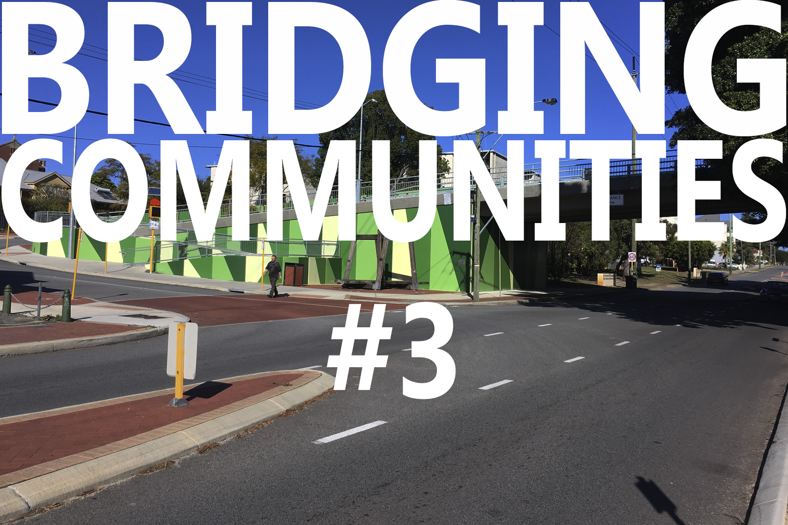
- #3 Seventh Avenue
- #4 Mt Lawley Station Bridge
- #5 Swanbourne Aboriginal History
- #6 Swanbourne European History
- #7 Swanbourne Hotel
- #8 Koombana Bay Bridge
- #9 BIG Bridge Copenhagen
- #10 Circle Bridge Copenhagen
- #11 Tulhus Bridge - Erik Andersson
- #12 RV73 Bridge - Erik Andersson
- #13 The Architect Bridge - Erik Andersson
- #14 Ruyi Bridge - China
- #15 Cork Ireland Bridge - O'Donnell + Tuomey Architects
- #16 Bat Bridge - Next Architects
- #17 Leederville & Claremont Bridges
- #18 Dawson's Garden Centre
- #19 Swanbourne Village
- #20 Cottesloe Central Bridge
- #21 Showgrounds Bridge
- #22 Art Overlays
- #23 Swanbourne Village - Parameters - Levels
- #24 Swanbourne Village - Parameters - Community Hub
- #25 Swanbourne Village - A Better Way
- #26 Swanbourne Village – Call in the Cavalry
- #27 Sydney Light Rail Bridge
- #28 Hamilton Street Bridge, Subiaco
- #29 Compare the Pair
- #30 Opportunity not a Barrier
- #31 Rose Garden Bridge
- #32 Somers Town Bridge
- #33 Swanbourne Village – Original Bridge
- #34 Bayswater Bridge
- #35 Main Roads WA Scheme
- #36 NCA Scheme – The Big Picture
- #37 NCA Scheme – Master Plan
- #38 NCA Scheme – Relocated Dawsons Garden Centre
- #39 NCA Scheme – New Built Form
- #40 NCA Scheme – A New Community Pedestrian Bridge
- #41 NCA Scheme – Proposed Train Station Precinct
- #42 NCA Scheme – Swanbourne Village Market Day
- #43 NCA Scheme – Pedestrian environment
- #44 NCA Scheme – Cultural overlay
- #45 NCA Scheme – Centre of Excellence for a Sustainable Future
- #46 NCA Scheme – An Alternative Pedestrian Bridge Design